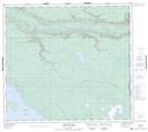
Maps showing Soda Creek, 11-20-89-3-W4, Alberta
Soda Creek is a River located in 11-20-89-3-W4, Alberta.
- Latitude: 56° 44' 6'' North (decimal: 56.7350000)
- Longitude: 110° 27' 1'' West (decimal: -110.4502777)
- Topography Feature Category: River
- Geographical Feature: Creek
- Canadian Province/Territory: Alberta
- Location: 11-20-89-3-W4
- Atlas of Canada Locator Map: Soda Creek
- GPS Coordinate Locator Map: Soda Creek Lat/Long
Soda Creek NTS Map Sheets