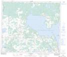
Maps showing Plamondon Bay, 18-68-15-W4, Alberta
Plamondon Bay is a Bay located in 18-68-15-W4, Alberta.
- Latitude: 54° 52' 45'' North (decimal: 54.8791666)
- Longitude: 112° 17' 19'' West (decimal: -112.2886111)
- Topography Feature Category: Bay
- Geographical Feature: Bay
- Canadian Province/Territory: Alberta
- Location: 18-68-15-W4
- Atlas of Canada Locator Map: Plamondon Bay
- GPS Coordinate Locator Map: Plamondon Bay Lat/Long
Plamondon Bay NTS Map Sheets