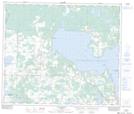
Maps showing Sandy Lake, 20-69-14-W4, Alberta
Sandy Lake is a Lake located in 20-69-14-W4, Alberta.
- Latitude: 54° 58' 57'' North (decimal: 54.9824999)
- Longitude: 112° 5' 29'' West (decimal: -112.0913888)
- Topography Feature Category: Lake
- Geographical Feature: Lake
- Canadian Province/Territory: Alberta
- Location: 20-69-14-W4
- Atlas of Canada Locator Map: Sandy Lake
- GPS Coordinate Locator Map: Sandy Lake Lat/Long
Sandy Lake NTS Map Sheets