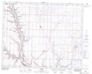
Maps showing Bolin Hill, 3-30-19-W4, Alberta
Bolin Hill is a Mountain located in 3-30-19-W4, Alberta.
- Latitude: 51° 32' 17'' North (decimal: 51.5380555)
- Longitude: 112° 35' 2'' West (decimal: -112.5838888)
- Topography Feature Category: Mountain
- Geographical Feature: Hill
- Canadian Province/Territory: Alberta
- Location: 3-30-19-W4
- Atlas of Canada Locator Map: Bolin Hill
- GPS Coordinate Locator Map: Bolin Hill Lat/Long