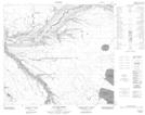
Maps showing Horseshoe Lake, 31-88-7-W4, Alberta
Horseshoe Lake is a Lake located in 31-88-7-W4, Alberta.
- Latitude: 56° 39' 17'' North (decimal: 56.6547222)
- Longitude: 110° 59' 41'' West (decimal: -110.9947222)
- Topography Feature Category: Lake
- Geographical Feature: Lake
- Canadian Province/Territory: Alberta
- Location: 31-88-7-W4
- Atlas of Canada Locator Map: Horseshoe Lake
- GPS Coordinate Locator Map: Horseshoe Lake Lat/Long
Horseshoe Lake NTS Map Sheets