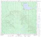
Maps showing Halfway Creek, 13-86-9-W4, Alberta
Halfway Creek is a River located in 13-86-9-W4, Alberta.
- Latitude: 56° 27' 25'' North (decimal: 56.4569444)
- Longitude: 111° 16' 45'' West (decimal: -111.2791667)
- Topography Feature Category: River
- Geographical Feature: Creek
- Canadian Province/Territory: Alberta
- Location: 13-86-9-W4
- Atlas of Canada Locator Map: Halfway Creek
- GPS Coordinate Locator Map: Halfway Creek Lat/Long
Halfway Creek NTS Map Sheets