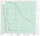
Maps showing Williams Lake, 16-90-7-W4, Alberta
Williams Lake is a Lake located in 16-90-7-W4, Alberta.
- Latitude: 56° 48' 10'' North (decimal: 56.8027777)
- Longitude: 110° 4' 13'' West (decimal: -110.0702778)
- Topography Feature Category: Lake
- Geographical Feature: Lake
- Canadian Province/Territory: Alberta
- Location: 16-90-7-W4
- Atlas of Canada Locator Map: Williams Lake
- GPS Coordinate Locator Map: Williams Lake Lat/Long
Williams Lake NTS Map Sheets