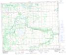
Maps showing Genesee Lake, 26,27-50-3-W5, Alberta
Genesee Lake is a Lake located in 26,27-50-3-W5, Alberta.
- Latitude: 53° 20' 35'' North (decimal: 53.3430555)
- Longitude: 114° 20' 32'' West (decimal: -114.3422221)
- Topography Feature Category: Lake
- Geographical Feature: Reservoir
- Canadian Province/Territory: Alberta
- Location: 26,27-50-3-W5
- Atlas of Canada Locator Map: Genesee Lake
- GPS Coordinate Locator Map: Genesee Lake Lat/Long
Genesee Lake NTS Map Sheets