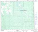
Maps showing Willow Opening Creek, 35-71-15-W5, Alberta
Willow Opening Creek is a River located in 35-71-15-W5, Alberta.
- Latitude: 55° 11' 54'' North (decimal: 55.1983332)
- Longitude: 116° 11' 58'' West (decimal: -116.1994443)
- Topography Feature Category: River
- Geographical Feature: Creek
- Canadian Province/Territory: Alberta
- Location: 35-71-15-W5
- Atlas of Canada Locator Map: Willow Opening Creek
- GPS Coordinate Locator Map: Willow Opening Creek Lat/Long
Willow Opening Creek NTS Map Sheets