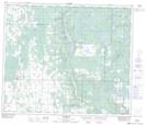
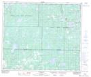
Maps showing Buffalo Lake Metis Settlement, Alberta
Buffalo Lake Metis Settlement is a Unincorporated area located in Alberta.
- Latitude: 54° 29' North (decimal: 54.4832999)
- Longitude: 112° 26' West (decimal: -112.4333000)
- Topography Feature Category: Unincorporated area
- Geographical Feature: Metis Settlement
- Canadian Province/Territory: Alberta
- Atlas of Canada Locator Map: Buffalo Lake Metis Settlement
- GPS Coordinate Locator Map: Buffalo Lake Metis Settlement Lat/Long
Buffalo Lake Metis Settlement NTS Map Sheets