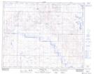
Maps showing Spiers Lake National Wildlife Area, Alberta
Spiers Lake National Wildlife Area is a Conservation area located in Alberta and has an elevation of 812 meters.
- Latitude: 51° 55' 20'' North (decimal: 51.9222222)
- Longitude: 112° 14' 30'' West (decimal: -112.2416666)
- Topography Feature Category: Conservation area
- Geographical Feature: National Wildlife Area
- Canadian Province/Territory: Alberta
- Elevation: 812 meters
- Atlas of Canada Locator Map: Spiers Lake National Wildlife Area
- GPS Coordinate Locator Map: Spiers Lake National Wildlife Area Lat/Long
Spiers Lake National Wildlife Area NTS Map Sheets