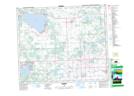
Maps showing Alexis, 11-55-4-W5, Alberta
Alexis is a Unincorporated area located in 11-55-4-W5, Alberta.
- Latitude: 53° 44' 56'' North (decimal: 53.7488889)
- Longitude: 114° 29' 11'' West (decimal: -114.4863888)
- Topography Feature Category: Unincorporated area
- Geographical Feature: Locality
- Canadian Province/Territory: Alberta
- Location: 11-55-4-W5
- Atlas of Canada Locator Map: Alexis
- GPS Coordinate Locator Map: Alexis Lat/Long
Alexis NTS Map Sheets