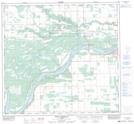
Maps showing Boyer 164, 11,9,19, Alberta
Boyer 164 is a Indian Reserve located in 11,9,19, Alberta.
- Latitude: 58° 27' 24'' North (decimal: 58.4566666)
- Longitude: 116° 15' 40'' West (decimal: -116.2611111)
- Topography Feature Category: Indian Reserve
- Geographical Feature: Indian Reserve - Réserve indienne
- Canadian Province/Territory: Alberta
- Location: 11,9,19
- Atlas of Canada Locator Map: Boyer 164
- GPS Coordinate Locator Map: Boyer 164 Lat/Long
Boyer 164 NTS Map Sheets