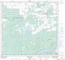
Maps showing Child Lake 164A, 15-109-16-W5, Alberta
Child Lake 164A is a Indian Reserve located in 15-109-16-W5, Alberta.
- Latitude: 58° 28' 15'' North (decimal: 58.4708333)
- Longitude: 116° 35' 4'' West (decimal: -116.5844443)
- Topography Feature Category: Indian Reserve
- Geographical Feature: Indian Reserve - Réserve indienne
- Canadian Province/Territory: Alberta
- Location: 15-109-16-W5
- Atlas of Canada Locator Map: Child Lake 164A
- GPS Coordinate Locator Map: Child Lake 164A Lat/Long
Child Lake 164A NTS Map Sheets