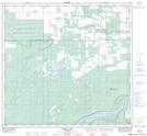
Maps showing Bushe River 207, 10,109,18, Alberta
Bushe River 207 is a Indian Reserve located in 10,109,18, Alberta.
- Latitude: 58° 29' 5'' North (decimal: 58.4847222)
- Longitude: 116° 58' 41'' West (decimal: -116.9780556)
- Topography Feature Category: Indian Reserve
- Geographical Feature: Indian Reserve - Réserve indienne
- Canadian Province/Territory: Alberta
- Location: 10,109,18
- Atlas of Canada Locator Map: Bushe River 207
- GPS Coordinate Locator Map: Bushe River 207 Lat/Long
Bushe River 207 NTS Map Sheets