Maps showing Sturgeon Lake 154, 70-23-W5, Alberta
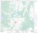
Sturgeon Lake 154 is a Indian Reserve located in 70-23-W5, Alberta.
- Latitude: 55° 3' 36'' North (decimal: 55.0599999)
- Longitude: 117° 28' 29'' West (decimal: -117.4747221)
- Topography Feature Category: Indian Reserve
- Geographical Feature: Indian Reserve - Réserve indienne
- Canadian Province/Territory: Alberta
- Location: 70-23-W5
- Atlas of Canada Locator Map: Sturgeon Lake 154
- GPS Coordinate Locator Map: Sturgeon Lake 154 Lat/Long
Sturgeon Lake 154 NTS Map Sheets