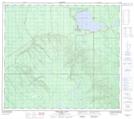
Maps showing Gregoire Lake 176B, 24-86-8-W4, Alberta
Gregoire Lake 176B is a Indian Reserve located in 24-86-8-W4, Alberta.
- Latitude: 56° 28' 10'' North (decimal: 56.4694444)
- Longitude: 111° 6' 53'' West (decimal: -111.1147222)
- Topography Feature Category: Indian Reserve
- Geographical Feature: Indian Reserve - Réserve indienne
- Canadian Province/Territory: Alberta
- Location: 24-86-8-W4
- Atlas of Canada Locator Map: Gregoire Lake 176B
- GPS Coordinate Locator Map: Gregoire Lake 176B Lat/Long
Gregoire Lake 176B NTS Map Sheets