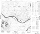
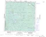
Maps showing Peace Point 222, 116,117-15-W4, Alberta
Peace Point 222 is a Indian Reserve located in 116,117-15-W4, Alberta.
- Latitude: 59° 8' 00'' North (decimal: 59.1333333)
- Longitude: 112° 26' 10'' West (decimal: -112.4361110)
- Topography Feature Category: Indian Reserve
- Geographical Feature: Indian Reserve - Réserve indienne
- Canadian Province/Territory: Alberta
- Location: 116,117-15-W4
- Atlas of Canada Locator Map: Peace Point 222
- GPS Coordinate Locator Map: Peace Point 222 Lat/Long
Peace Point 222 NTS Map Sheets