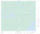
Maps showing Winefred Lake 194B, 76-4-W4, Alberta
Winefred Lake 194B is a Indian Reserve located in 76-4-W4, Alberta.
- Latitude: 55° 35' 15'' North (decimal: 55.5875000)
- Longitude: 110° 31' 0'' West (decimal: -110.5166667)
- Topography Feature Category: Indian Reserve
- Geographical Feature: Indian Reserve - Réserve indienne
- Canadian Province/Territory: Alberta
- Location: 76-4-W4
- Atlas of Canada Locator Map: Winefred Lake 194B
- GPS Coordinate Locator Map: Winefred Lake 194B Lat/Long
Winefred Lake 194B NTS Map Sheets