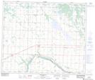
Maps showing Lungul Lake, 20-60-17-W4, Alberta
Lungul Lake is a Lake located in 20-60-17-W4, Alberta.
- Latitude: 54° 11' 45'' North (decimal: 54.1958333)
- Longitude: 112° 31' 14'' West (decimal: -112.5205555)
- Topography Feature Category: Lake
- Geographical Feature: Lake
- Canadian Province/Territory: Alberta
- Location: 20-60-17-W4
- Atlas of Canada Locator Map: Lungul Lake
- GPS Coordinate Locator Map: Lungul Lake Lat/Long
Lungul Lake NTS Map Sheets