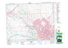
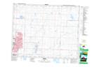
Maps showing Refuge d'oiseaux d'Inglewood, Alberta
Refuge d'oiseaux d'Inglewood is a Conservation area located in Alberta and has an elevation of 1046 meters.
- Latitude: 51° 1' 30'' North (decimal: 51.0250000)
- Longitude: 114° 0' 0'' West (decimal: -114.0000000)
- Topography Feature Category: Conservation area
- Geographical Feature: Refuge d'oiseaux migrateurs
- Canadian Province/Territory: Alberta
- Elevation: 1046 meters
- Atlas of Canada Locator Map: Refuge d'oiseaux d'Inglewood
- GPS Coordinate Locator Map: Refuge d'oiseaux d'Inglewood Lat/Long
Refuge d'oiseaux d'Inglewood NTS Map Sheets