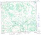
Maps showing Eagle Point Provincial Park, 11-30-49-6-5, Alberta
Eagle Point Provincial Park is a Conservation area located in 11-30-49-6-5, Alberta.
- Latitude: 53° 15' 28'' North (decimal: 53.2577999)
- Longitude: 114° 51' 57'' West (decimal: -114.8657999)
- Topography Feature Category: Conservation area
- Geographical Feature: Provincial Park
- Canadian Province/Territory: Alberta
- Location: 11-30-49-6-5
- Atlas of Canada Locator Map: Eagle Point Provincial Park
- GPS Coordinate Locator Map: Eagle Point Provincial Park Lat/Long
Eagle Point Provincial Park NTS Map Sheets