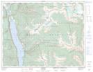
Maps showing Eagle Nest Lake, Kootenay Land District, British Columbia
Eagle Nest Lake is a Lake located in Kootenay Land District, British Columbia and has an elevation of 2275 meters.
- Latitude: 50° 11' 25'' North (decimal: 50.1902778)
- Longitude: 116° 34' 37'' West (decimal: -116.576944)
- Topography Feature Category: Lake
- Geographical Feature: Lake
- Canadian Province/Territory: British Columbia
- Elevation: 2275 meters
- Location: Kootenay Land District
- Atlas of Canada Locator Map: Eagle Nest Lake
- GPS Coordinate Locator Map: Eagle Nest Lake Lat/Long