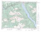
Maps showing Eagle Pass, Kamloops Division Yale Land District, British Columbia
Eagle Pass is a Valley located in Kamloops Division Yale Land District, British Columbia and has an elevation of 742 meters.
- Latitude: 50° 57' 55'' North (decimal: 50.9652778)
- Longitude: 118° 22' 10'' West (decimal: -118.369444)
- Topography Feature Category: Valley
- Geographical Feature: Pass
- Canadian Province/Territory: British Columbia
- Elevation: 742 meters
- Location: Kamloops Division Yale Land District
- Atlas of Canada Locator Map: Eagle Pass
- GPS Coordinate Locator Map: Eagle Pass Lat/Long