Canada Topographic Maps

Beavercrow Ridge Topo Maps

Topography maps and Latitude/Longitude Location

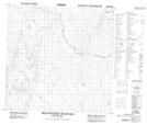
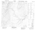
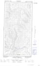
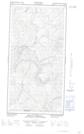
Maps showing Beavercrow Ridge, Peace River Land District, British Columbia

Beavercrow Ridge is a Mountain located in Peace River Land District, British Columbia and has an elevation of 1315 meters.

  • Latitude: 59° 57' 6'' North   (decimal: 59.9516667)
  • Longitude: 125° 5' 20'' West   (decimal: -125.088889)
  • Topography Feature Category: Mountain
  • Geographical Feature: Ridge
  • Canadian Province/Territory: British Columbia
  • Elevation: 1315 meters
  • Location: Peace River Land District
  • Atlas of Canada Locator Map: Beavercrow Ridge
  • GPS Coordinate Locator Map: Beavercrow Ridge Lat/Long

Beavercrow Ridge NTS Map Sheets

094N14 Beavercrow Mountain Topographic Map at 1:50,000 scale

094N15 Crow River Topographic Map at 1:50,000 scale

095C02E Mount Merrill Topographic Map at 1:50,000 scale

095C02W Mount Merrill Topographic Map at 1:50,000 scale

095C03E Mooney Creek Topographic Map at 1:50,000 scale

095C03W Mooney Creek Topographic Map at 1:50,000 scale

094N Toad River Topographic Map at 1:250,000 scale

095C La Biche River Topographic Map at 1:250,000 scale

 
Buy Topographic Maps DVD
Newsletter Sign-up

Yes, I want to receive map store discounts.


Bookmark and Share