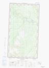
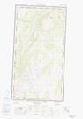
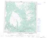
Maps showing Kaketsa Mountain, Cassiar Land District, British Columbia
Kaketsa Mountain is a Mountain located in Cassiar Land District, British Columbia.
- Latitude: 58° 13' 27'' North (decimal: 58.2241666)
- Longitude: 131° 49' 17'' West (decimal: -131.8213888)
- Topography Feature Category: Mountain
- Geographical Feature: Mountain
- Canadian Province/Territory: British Columbia
- Location: Cassiar Land District
- Atlas of Canada Locator Map: Kaketsa Mountain
- GPS Coordinate Locator Map: Kaketsa Mountain Lat/Long
Kaketsa Mountain NTS Map Sheets