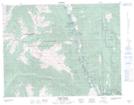
Maps showing Cattle Valley Creek, British Columbia
Cattle Valley Creek is a River located in British Columbia.
- Latitude: 50° 19' 30'' North (decimal: 50.3249998)
- Longitude: 121° 58' 35'' West (decimal: -121.9763888)
- Topography Feature Category: River
- Geographical Feature: Creek
- Canadian Province/Territory: British Columbia
- Atlas of Canada Locator Map: Cattle Valley Creek
- GPS Coordinate Locator Map: Cattle Valley Creek Lat/Long
Cattle Valley Creek NTS Map Sheets