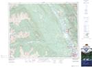
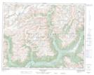
Maps showing Mount Kindersley, Kootenay Land District, British Columbia
Mount Kindersley is a Mountain located in Kootenay Land District, British Columbia and has an elevation of 2398 meters.
- Latitude: 50° 44' 17'' North (decimal: 50.7380555)
- Longitude: 116° 1' 10'' West (decimal: -116.0194444)
- Topography Feature Category: Mountain
- Geographical Feature: Mount
- Canadian Province/Territory: British Columbia
- Elevation: 2398 meters
- Location: Kootenay Land District
- Atlas of Canada Locator Map: Mount Kindersley
- GPS Coordinate Locator Map: Mount Kindersley Lat/Long
Mount Kindersley NTS Map Sheets