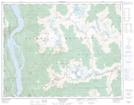
Maps showing Birnam Falls, Kootenay Land District, British Columbia
Birnam Falls is a Falls located in Kootenay Land District, British Columbia.
- Latitude: 50° 22' 57'' North (decimal: 50.3824999)
- Longitude: 116° 47' 43'' West (decimal: -116.7953000)
- Topography Feature Category: Falls
- Geographical Feature: Falls
- Canadian Province/Territory: British Columbia
- Location: Kootenay Land District
- Atlas of Canada Locator Map: Birnam Falls
- GPS Coordinate Locator Map: Birnam Falls Lat/Long
Birnam Falls NTS Map Sheets