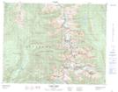
Maps showing Gates Ledge, Kootenay Land District, British Columbia
Gates Ledge is a Mountain located in Kootenay Land District, British Columbia and has an elevation of 2130 meters.
- Latitude: 50° 31' 34'' North (decimal: 50.5261111)
- Longitude: 118° 10' 58'' West (decimal: -118.1827777)
- Topography Feature Category: Mountain
- Geographical Feature: Ledge
- Canadian Province/Territory: British Columbia
- Elevation: 2130 meters
- Location: Kootenay Land District
- Atlas of Canada Locator Map: Gates Ledge
- GPS Coordinate Locator Map: Gates Ledge Lat/Long