Maps showing Chilcotin River, Lillooet Land District, British Columbia
Chilcotin River is a River located in Lillooet Land District, British Columbia and has an elevation of 438 meters.
- Latitude: 51° 44' North (decimal: 51.7332999)
- Longitude: 122° 24' West (decimal: -122.4000000)
- Topography Feature Category: River
- Geographical Feature: River
- Canadian Province/Territory: British Columbia
- Elevation: 438 meters
- Location: Lillooet Land District
- Atlas of Canada Locator Map: Chilcotin River
- GPS Coordinate Locator Map: Chilcotin River Lat/Long
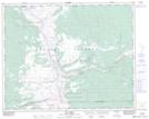
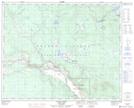
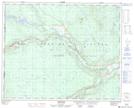
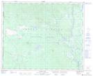
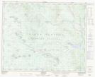
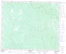
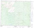
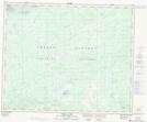
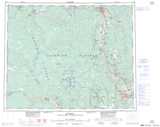
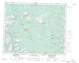
Chilcotin River NTS Map Sheets
092O09 Dog Creek Topographic Map at 1:50,000 scale
093B03 Alexis Creek Topographic Map at 1:50,000 scale
093B04 Redstone Topographic Map at 1:50,000 scale
093B05 Loomis Lake Topographic Map at 1:50,000 scale
093C08 Chezacut Topographic Map at 1:50,000 scale
093C09 Clusko River Topographic Map at 1:50,000 scale
093C10 Downton Creek Topographic Map at 1:50,000 scale
093C15 Kushya River Topographic Map at 1:50,000 scale
092O Taseko Lakes Topographic Map at 1:250,000 scale
093B Quesnel Topographic Map at 1:250,000 scale
093C Anahim Lake Topographic Map at 1:250,000 scale