Maps showing Strait of Georgia, Nanaimo Land District, British Columbia
Strait of Georgia is a Channel located in Nanaimo Land District, British Columbia and has an elevation of 0 meters.
- Latitude: 49° 30' North (decimal: 49.5000000)
- Longitude: 124° 00' West (decimal: -123.9999999)
- Topography Feature Category: Channel
- Geographical Feature: Strait
- Canadian Province/Territory: British Columbia
- Elevation: 0 meters
- Location: Nanaimo Land District
- Atlas of Canada Locator Map: Strait of Georgia
- GPS Coordinate Locator Map: Strait of Georgia Lat/Long
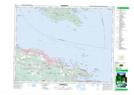
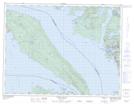
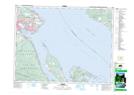
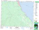
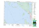
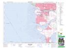
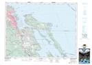
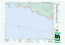
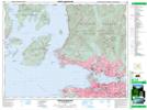
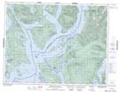
Strait of Georgia NTS Map Sheets
092B13 Duncan Topographic Map at 1:50,000 scale
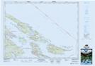
092B14 Mayne Island Topographic Map at 1:50,000 scale
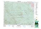
092F01 Nanaimo Lakes Topographic Map at 1:50,000 scale
092F07 Horne Lake Topographic Map at 1:50,000 scale
092F08 Parksville Topographic Map at 1:50,000 scale
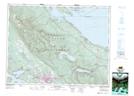
092F09 Texada Island Topographic Map at 1:50,000 scale
092F10 Comox Topographic Map at 1:50,000 scale
092F14 Oyster River Topographic Map at 1:50,000 scale
092F15 Powell River Topographic Map at 1:50,000 scale
092G03 Lulu Island Topographic Map at 1:50,000 scale
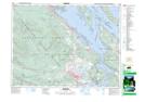
092G04 Nanaimo Topographic Map at 1:50,000 scale
092G05 Sechelt Topographic Map at 1:50,000 scale
092G06 North Vancouver Topographic Map at 1:50,000 scale
092K02 Desolation Sound Topographic Map at 1:50,000 scale
092B Victoria Topographic Map at 1:250,000 scale
092F Port Alberni Topographic Map at 1:250,000 scale
092G Vancouver Topographic Map at 1:250,000 scale
092K Bute Inlet Topographic Map at 1:250,000 scale