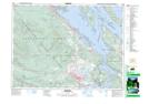
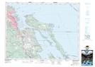
Maps showing Moore Hill, Cowichan Land District, British Columbia
Moore Hill is a Mountain located in Cowichan Land District, British Columbia and has an elevation of 50 meters.
- Latitude: 49° 0' 17'' North (decimal: 49.0047222)
- Longitude: 123° 40' 21'' West (decimal: -123.6724999)
- Topography Feature Category: Mountain
- Geographical Feature: Hill
- Canadian Province/Territory: British Columbia
- Elevation: 50 meters
- Location: Cowichan Land District
- Atlas of Canada Locator Map: Moore Hill
- GPS Coordinate Locator Map: Moore Hill Lat/Long
Moore Hill NTS Map Sheets