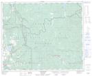
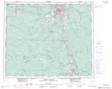
Maps showing Moose Heights Park, Cariboo Land District, British Columbia
Moose Heights Park is a Conservation area located in Cariboo Land District, British Columbia.
- Latitude: 53° 5' 30'' North (decimal: 53.0916999)
- Longitude: 122° 27' 30'' West (decimal: -122.4582999)
- Topography Feature Category: Conservation area
- Geographical Feature: Provincial Park
- Canadian Province/Territory: British Columbia
- Location: Cariboo Land District
- GPS Coordinate Locator Map: Moose Heights Park Lat/Long
Moose Heights Park NTS Map Sheets