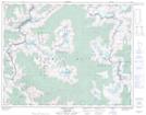
Maps showing The Steeples, Kootenay Land District, British Columbia
The Steeples is a Mountain located in Kootenay Land District, British Columbia and has an elevation of 2625 meters.
- Latitude: 50° 49' 31'' North (decimal: 50.8252777)
- Longitude: 117° 3' 23'' West (decimal: -117.0563888)
- Topography Feature Category: Mountain
- Geographical Feature: Peaks
- Canadian Province/Territory: British Columbia
- Elevation: 2625 meters
- Location: Kootenay Land District
- Atlas of Canada Locator Map: The Steeples
- GPS Coordinate Locator Map: The Steeples Lat/Long
The Steeples NTS Map Sheets