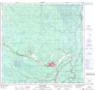
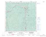
Maps showing Fort Nelson, Peace River Land District, British Columbia
Fort Nelson is a Unincorporated area located in Peace River Land District, British Columbia.
- Latitude: 58° 49' North (decimal: 58.8167000)
- Longitude: 122° 33' West (decimal: -122.5499999)
- Topography Feature Category: Unincorporated area
- Geographical Feature: Settlement
- Canadian Province/Territory: British Columbia
- Location: Peace River Land District
- GPS Coordinate Locator Map: Fort Nelson Lat/Long
Fort Nelson NTS Map Sheets