Canada Topographic Maps

Gataga River Topo Maps

Topography maps and Latitude/Longitude Location

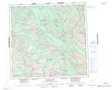
Maps showing Gataga River, Cassiar Land District, British Columbia

Gataga River is a River located in Cassiar Land District, British Columbia.

  • Latitude: 58° 35' North   (decimal: 58.5832999)
  • Longitude: 126° 55' West   (decimal: -126.9166999)
  • Topography Feature Category: River
  • Geographical Feature: River
  • Canadian Province/Territory: British Columbia
  • Location: Cassiar Land District
  • Atlas of Canada Locator Map: Gataga River
  • GPS Coordinate Locator Map: Gataga River Lat/Long

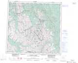
Gataga River NTS Map Sheets

094K02 Sicily Mountain Topographic Map at 1:50,000 scale

094K03 Churchill Peak Topographic Map at 1:50,000 scale

094K04 No Title Topographic Map at 1:50,000 scale

094K05 No Title Topographic Map at 1:50,000 scale

094L07 Paddy Creek Topographic Map at 1:50,000 scale

094L08 Through Creek Topographic Map at 1:50,000 scale

094L10 Gataga Mountain Topographic Map at 1:50,000 scale

094K Tuchodi Lakes Topographic Map at 1:250,000 scale

094L Kechika River Topographic Map at 1:250,000 scale

 
Buy Topographic Maps DVD
Newsletter Sign-up

Yes, I want to receive map store discounts.


Bookmark and Share