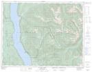
Maps showing Nakusp Hot Springs Park, Kootenay Land District, British Columbia
Nakusp Hot Springs Park is a Conservation area located in Kootenay Land District, British Columbia.
- Latitude: 50° 17' 45'' North (decimal: 50.2958000)
- Longitude: 117° 40' 40'' West (decimal: -117.6777999)
- Topography Feature Category: Conservation area
- Geographical Feature: Provincial Park
- Canadian Province/Territory: British Columbia
- Location: Kootenay Land District
- GPS Coordinate Locator Map: Nakusp Hot Springs Park Lat/Long
Nakusp Hot Springs Park NTS Map Sheets