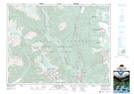
Maps showing Atwell Peak, New Westminster Land District, British Columbia
Atwell Peak is a Mountain located in New Westminster Land District, British Columbia and has an elevation of 2298 meters.
- Latitude: 49° 50' 28'' North (decimal: 49.8411111)
- Longitude: 123° 0' 33'' West (decimal: -123.0091666)
- Topography Feature Category: Mountain
- Geographical Feature: Peak
- Canadian Province/Territory: British Columbia
- Elevation: 2298 meters
- Location: New Westminster Land District
- Atlas of Canada Locator Map: Atwell Peak
- GPS Coordinate Locator Map: Atwell Peak Lat/Long
Atwell Peak NTS Map Sheets