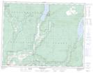
Maps showing Mabel Lake Park, Osoyoos Division Yale Land District, British Columbia
Mabel Lake Park is a Conservation area located in Osoyoos Division Yale Land District, British Columbia and has an elevation of 496 meters.
- Latitude: 50° 27' 40'' North (decimal: 50.4611000)
- Longitude: 118° 43' 25'' West (decimal: -118.7235999)
- Topography Feature Category: Conservation area
- Geographical Feature: Provincial Park
- Canadian Province/Territory: British Columbia
- Elevation: 496 meters
- Location: Osoyoos Division Yale Land District
- Atlas of Canada Locator Map: Mabel Lake Park
- GPS Coordinate Locator Map: Mabel Lake Park Lat/Long
Mabel Lake Park NTS Map Sheets