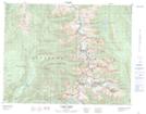
Maps showing Mount Thor, Kootenay Land District, British Columbia
Mount Thor is a Mountain located in Kootenay Land District, British Columbia and has an elevation of 2482 meters.
- Latitude: 50° 35' 38'' North (decimal: 50.5938888)
- Longitude: 118° 6' 6'' West (decimal: -118.1016666)
- Topography Feature Category: Mountain
- Geographical Feature: Mount
- Canadian Province/Territory: British Columbia
- Elevation: 2482 meters
- Location: Kootenay Land District
- Atlas of Canada Locator Map: Mount Thor
- GPS Coordinate Locator Map: Mount Thor Lat/Long