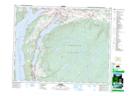
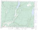
Maps showing Duteau Creek, Osoyoos Division Yale Land District, British Columbia
Duteau Creek is a River located in Osoyoos Division Yale Land District, British Columbia and has an elevation of 1216 meters.
- Latitude: 50° 15' 5'' North (decimal: 50.2513889)
- Longitude: 118° 57' 37'' West (decimal: -118.960278)
- Topography Feature Category: River
- Geographical Feature: Creek
- Canadian Province/Territory: British Columbia
- Elevation: 1216 meters
- Location: Osoyoos Division Yale Land District
- Atlas of Canada Locator Map: Duteau Creek
- GPS Coordinate Locator Map: Duteau Creek Lat/Long
Duteau Creek NTS Map Sheets