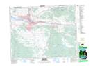
Maps showing Scuitto Lake, Kamloops Division Yale Land District, British Columbia
Scuitto Lake is a Lake located in Kamloops Division Yale Land District, British Columbia and has an elevation of 1063 meters.
- Latitude: 50° 32' 56'' North (decimal: 50.5488889)
- Longitude: 120° 8' 13'' West (decimal: -120.136944)
- Topography Feature Category: Lake
- Geographical Feature: Lake
- Canadian Province/Territory: British Columbia
- Elevation: 1063 meters
- Location: Kamloops Division Yale Land District
- Atlas of Canada Locator Map: Scuitto Lake
- GPS Coordinate Locator Map: Scuitto Lake Lat/Long