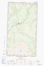
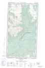
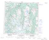
Maps showing Dodjatin Mountain, Cassiar Land District, British Columbia
Dodjatin Mountain is a Mountain located in Cassiar Land District, British Columbia.
- Latitude: 57° 55' 47'' North (decimal: 57.9297222)
- Longitude: 131° 16' 42'' West (decimal: -131.2783333)
- Topography Feature Category: Mountain
- Geographical Feature: Mountain
- Canadian Province/Territory: British Columbia
- Location: Cassiar Land District
- Atlas of Canada Locator Map: Dodjatin Mountain
- GPS Coordinate Locator Map: Dodjatin Mountain Lat/Long
Dodjatin Mountain NTS Map Sheets