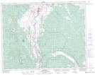
Maps showing Oregon Jack Hill, Kamloops Division Yale Land District, British Columbia
Oregon Jack Hill is a Mountain located in Kamloops Division Yale Land District, British Columbia and has an elevation of 383 meters.
- Latitude: 50° 34' 26'' North (decimal: 50.5738889)
- Longitude: 121° 18' 17'' West (decimal: -121.304722)
- Topography Feature Category: Mountain
- Geographical Feature: Hill
- Canadian Province/Territory: British Columbia
- Elevation: 383 meters
- Location: Kamloops Division Yale Land District
- Atlas of Canada Locator Map: Oregon Jack Hill
- GPS Coordinate Locator Map: Oregon Jack Hill Lat/Long