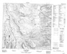
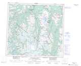
Maps showing Ornostay Bluff, Cassiar Land District, British Columbia
Ornostay Bluff is a Mountain located in Cassiar Land District, British Columbia.
- Latitude: 57° 42' 16'' North (decimal: 57.7044444)
- Longitude: 130° 42' 37'' West (decimal: -130.7102777)
- Topography Feature Category: Mountain
- Geographical Feature: Bluff
- Canadian Province/Territory: British Columbia
- Location: Cassiar Land District
- Atlas of Canada Locator Map: Ornostay Bluff
- GPS Coordinate Locator Map: Ornostay Bluff Lat/Long
Ornostay Bluff NTS Map Sheets