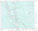
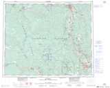
Maps showing McLeese Lake, Cariboo Land District, British Columbia
McLeese Lake is a Unincorporated area located in Cariboo Land District, British Columbia and has an elevation of 690 meters.
- Latitude: 52° 25' 12'' North (decimal: 52.42)
- Longitude: 122° 17' 43'' West (decimal: -122.295278)
- Topography Feature Category: Unincorporated area
- Geographical Feature: Community
- Canadian Province/Territory: British Columbia
- Elevation: 690 meters
- Location: Cariboo Land District
- Atlas of Canada Locator Map: McLeese Lake
- GPS Coordinate Locator Map: McLeese Lake Lat/Long