Maps showing Robson Valley, Cariboo Land District, British Columbia
Robson Valley is a Valley located in Cariboo Land District, British Columbia and has an elevation of 724 meters.
- Latitude: 53° 15' North (decimal: 53.2499999)
- Longitude: 120° 0' West (decimal: -120.0000000)
- Topography Feature Category: Valley
- Geographical Feature: Valley
- Canadian Province/Territory: British Columbia
- Elevation: 724 meters
- Location: Cariboo Land District
- Atlas of Canada Locator Map: Robson Valley
- GPS Coordinate Locator Map: Robson Valley Lat/Long
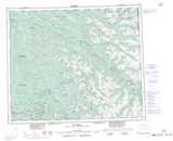
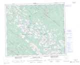
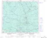
Robson Valley NTS Map Sheets
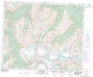
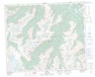
083D13 Kiwa Creek Topographic Map at 1:50,000 scale
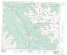
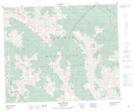
083D14 Valemount Topographic Map at 1:50,000 scale
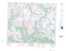
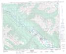
083E03 Mount Robson Topographic Map at 1:50,000 scale
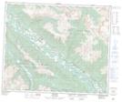
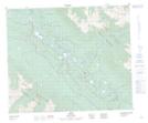
083E04 Croyden Topographic Map at 1:50,000 scale
093H01 Eddy Topographic Map at 1:50,000 scale
093H07 Goat River Topographic Map at 1:50,000 scale
093H08 Mcbride Topographic Map at 1:50,000 scale
093H10 Loos Topographic Map at 1:50,000 scale
083D Canoe River Topographic Map at 1:250,000 scale
083E Mount Robson Topographic Map at 1:250,000 scale
093H Mcbride Topographic Map at 1:250,000 scale
093I Monkman Pass Topographic Map at 1:250,000 scale
093J Mcleod Lake Topographic Map at 1:250,000 scale