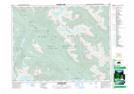
Maps showing Whiskey Lake, New Westminster Land District, British Columbia
Whiskey Lake is a Lake located in New Westminster Land District, British Columbia and has an elevation of 173 meters.
- Latitude: 49° 51' 14'' North (decimal: 49.8538889)
- Longitude: 122° 16' 44'' West (decimal: -122.278889)
- Topography Feature Category: Lake
- Geographical Feature: Lake
- Canadian Province/Territory: British Columbia
- Elevation: 173 meters
- Location: New Westminster Land District
- Atlas of Canada Locator Map: Whiskey Lake
- GPS Coordinate Locator Map: Whiskey Lake Lat/Long
Whiskey Lake NTS Map Sheets