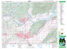
Maps showing Whatcom Road, New Westminster Land District, British Columbia
Whatcom Road is a Unincorporated area located in New Westminster Land District, British Columbia.
- Latitude: 49° 1' North (decimal: 49.0166999)
- Longitude: 122° 13' West (decimal: -122.2167000)
- Topography Feature Category: Unincorporated area
- Geographical Feature: Station
- Canadian Province/Territory: British Columbia
- Location: New Westminster Land District
- GPS Coordinate Locator Map: Whatcom Road Lat/Long